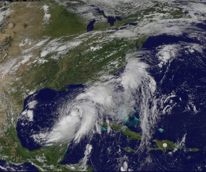
Today, Aug. 31 at 2 p.m. EDT, NOAA’s National Hurricane Center upgraded Depression 9 to Tropical Storm Hermine. NOAA’s GOES East satellite captured a visible image of Tropical Storm Hermine that showed the tropical storm organizing in the Gulf of Mexico.
Located roughly 540 miles west of Miami, Florida, Hermine’s maximum sustained winds have increased to near 40 miles per hour with higher gusts. According to the National Hurricane Center, additional strengthening is forecast during the next day or two, and the storm could be near hurricane strength by the time landfall occurs. Hermine is expected to make landfall in Florida’s “Big Bend” area on Sept. 1 with the center of the storm expected to come ashore later that night.
The combination of a dangerous storm surge and the tide will cause normally dry areas near the coast to be flooded by rising waters moving inland from the shoreline. There is a danger of life-threatening inundation within the next 36 to 48 hours along the Gulf coast of Florida from Aripeka to Indian Pass.
Visit the National Hurricane Center for up-to-date watches, warnings, and forecasts.


