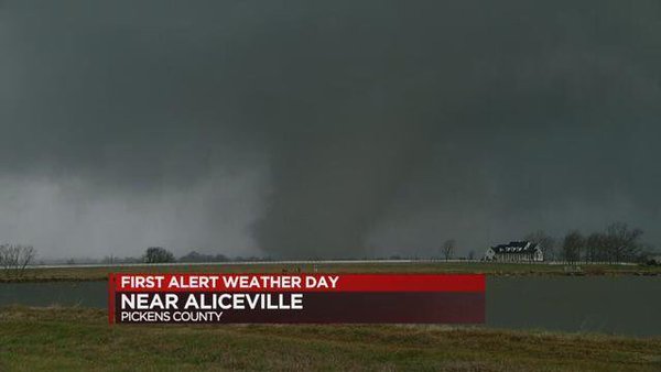
NASHVILLE — (Scroll down for video) –A major storm system tracking through the Central Plains will bring a myriad of weather to much of the eastern two-thirds of the CONUS. Strong to severe thunderstorms are expected to develop from the Gulf Coast northward into the Tennessee and Ohio Valleys as a cold front passes through. The Storm Prediction has highlight this region with an enhanced risk. Additionally, heavy rainfall is expected along this corridor, which may lead to flash flooding. Areas to the West and North of the low pressure center will have widespread snow.
Numerous Winter Storm Warnings and Blizzard Warnings are in effect from the Central Rockies to northern Michigan. Accumulations up to 6 inches will be common. Northern Wisconsin and Michigan are forecast to receive the highest snow amounts, which are forecast to range from 6 to 12+ inches. Snow will over parts of Northern New England that will slowly transition to all rain by Wednesday. Much of the Pacific Northwest Coast will have periods of heavy rain as a weakening system followed by another system pushes inland Wednesday.
The first system will produce coastal rain and higher elevation snow over parts of the Pacific Northwest into Northern California that will wind down during the overnight hours/early Wednesday morning. Another round of coastal rain and higher elevation snow over the Pacific Northwest/Northern California is forecast throughout Wednesday with the second system. Significant rainfall will likely occur for the Olympic peninsula over the next few days. Rainfall totals for the Northwest coastal areas are forecast between 1 and 4 inches. Isoalted areas may exceed 5 inches.
Time lapse of the developing tornado SW of Aliceville! @WBRCnews @WBRCweather pic.twitter.com/qzccJX5T0Z
— Jill Gilardi ☀️☔️⚡️ (@jillgilardi) February 2, 2016
Dramatic video of a tornado in Pickens County. Stay safe out there! pic.twitter.com/WyxjPPAX6Y
— Sally Pitts (@SallyPitts_WSFA) February 2, 2016

