
Hurricane Ida made landfall near Port Fourchon, Louisiana Sunday as a powerful Category 4 storm on the 16th anniversary of Hurricane Katrina.
According to the National Hurricane Center, Ida neared Category 5 strength as it approached the Gulf Coast. Ida had winds of 150 MPH — Category 5 hurricanes have winds of 157 MPH+.


BREAKING: Hurricane Ida has made landfall as an ‘extremely dangerous’ category 4 hurricane near Port Fourchon, Louisiana; Video taken this morning from inside the eye of the storm
— Breaking911 (@Breaking911) August 29, 2021
WATCH LIVE COVERAGE / EARTH CAMS:
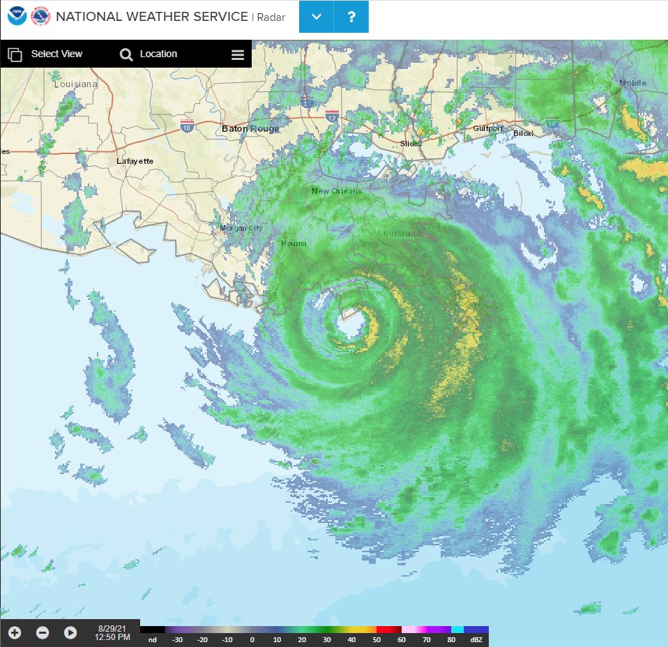
NOAA Doppler radar imagery indicates that the eye of Ida made landfall along the southeastern coast of Louisiana near Port Fourchon around 1155 AM CDT.
A NOAA National Ocean Service tide gauge in Shell Beach, Louisiana, recently reported a water level of 6.4 feet above mean higher high water, which is an approximation of inundation in that area.
A NOAA National Ocean Service tide gauge at Bay Waveland Yacht Club, Mississippi, recently reported a water level of 5.5 feet above mean higher high water, which is an approximation of inundation in that area.